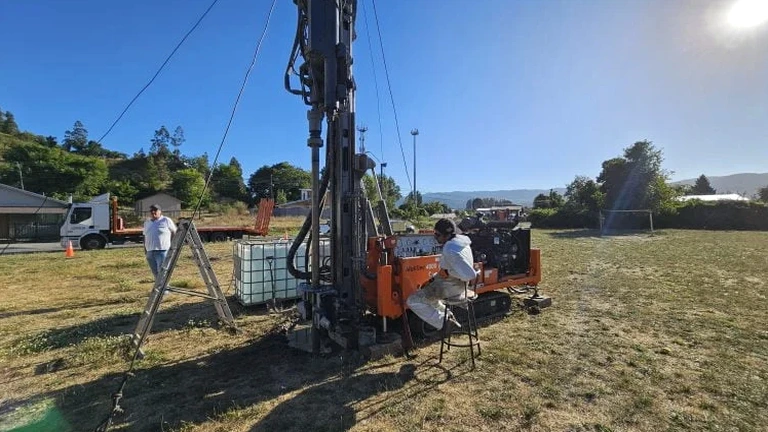
Last spring we were called out to a site off Kildaire Farm Road where a developer had already staked out a three-story medical office building. The initial desktop study suggested weathered Cecil sandy loam at grade, which is typical for this part of Wake County, but the project architect was uneasy about a low swale that crossed the southwest corner of the lot. We mobilized a track excavator the following morning and opened two 12-foot exploratory test pits right along the drainage line. At eight feet down we hit a lens of completely decomposed granite with visible slickensides—material that can lose significant bearing capacity when saturated. That single observation changed the foundation recommendation from isolated footings to a stiffened slab system, and it all came from being able to put an engineer directly in the hole to log the stratigraphy in three dimensions. In Cary, where the Piedmont residuum transitions from true saprolite to structured soil horizons over just a few hundred feet, an exploratory test pit gives you data that a boring log alone simply cannot capture. We combine field logging per ASTM D2488 with detailed photo documentation and infiltration rate measurements when stormwater management is part of the design package, which it almost always is in Cary's jurisdictional environment.
A single well-logged test pit in Cary's Piedmont residuum can reveal slickensides, groundwater perched on a Bt horizon, and refusal depth in one excavation—data that changes foundation design before the first footing is poured.
Methodology and scope
Local considerations
ASCE 7-22 Section 11.6 requires site-specific shear wave velocity data or a justified site class determination for seismic design in Cary, which falls within a region of moderate seismicity influenced by the Eastern Tennessee Seismic Zone and the occasional Charleston-source long-period event. The site class assignment is often based on the average shear wave velocity in the upper 100 feet, but when the upper 20 feet consist of residual soils with highly variable stiffness—something an exploratory test pit exposes directly—the default assumption of Site Class C or D can be dangerously optimistic or unnecessarily conservative. Piedmont residuum that appears competent in a split-spoon sample can have relict jointing, foliation planes, and clay-filled seams that reduce the mass stiffness significantly. By documenting these features in the exposed pit face, we provide the structural engineer with justification for a site-specific response spectrum rather than relying on the code-default values. The IBC 2021 explicitly permits using in-situ observations from test pits to refine the site classification when combined with appropriate geophysical measurements, and in Cary's competitive commercial construction market, that refinement often translates to a measurable reduction in lateral force demands on the structural frame.
Explanatory video
Applicable standards
ASTM D2488-17e1 (Visual-Manual Description of Soils), ASTM D2487-17 (Unified Soil Classification System), ASTM D3385-18 (Infiltration Rate via Double-Ring Infiltrometer), ASCE/SEI 7-22 (Minimum Design Loads, Site Classification), IBC 2021 Section 1803 (Geotechnical Investigations)
Associated technical services
Infiltration Testing Package
We run full-scale double-ring infiltrometer tests directly in the pit bottom at the proposed BMP invert elevation. The test follows ASTM D3385 methodology with a minimum six-hour saturation period and data reduction using the Philip two-term equation. Cary's stormwater review process requires design infiltration rates backed by in-situ measurements, and this package delivers exactly the data format that Town reviewers expect.
Geologic Hazard Screening
Using the exposed pit face, we map relict joints, slickensides, and saprolitic boulders that constitute geologic hazards for foundation construction. This screening aligns with the NCDEQ geohazards mapping initiative for Wake County and supports the geotechnical engineer's professional opinion regarding excavation stability, rock excavation quantities, and groundwater control measures.
Typical parameters
Frequently asked questions
What depth of exploratory test pit is typically needed for a single-family residential foundation in Cary?
For most slab-on-grade and crawl space foundations in Cary's Piedmont residuum, we target a depth of 10 to 12 feet below existing grade. This depth typically penetrates through the Bt horizon—where seasonal moisture-related volume change is most pronounced—and reaches the partially weathered rock or competent saprolite that serves as the bearing stratum. The Town of Cary may request documentation that the pit extends at least 3 feet below the proposed bottom of footing elevation to satisfy IBC Section 1803 requirements.
Can you run an infiltration test in the same exploratory test pit used for the geotechnical investigation?
Yes, and in fact we recommend doing so whenever stormwater infiltration is part of the site plan. We excavate the pit to the proposed BMP invert elevation or to the target infiltration horizon, log the exposed profile for geotechnical purposes, and then run the double-ring infiltrometer test directly in the pit bottom. The combined approach saves mobilization costs and gives you a single report with both bearing capacity data and the design infiltration rate in the same stratigraphic context.
How does the residual soil profile in Cary affect the reliability of test pit observations?
The Piedmont residuum in Cary is derived from weathered felsic crystalline rock—primarily granitic gneiss and diorite—and the transition from structured soil to saprolite to partially weathered rock can be extremely gradational. Relict foliation planes and quartz veins often persist into the soil column, and these features are visible in a test pit face but would be entirely missed in a split-spoon sample. Our field geologists are trained specifically on Piedmont saprolite logging and can distinguish between relict structures and active discontinuities that affect slope stability and foundation performance.
What is the typical cost range for an exploratory test pit in Cary?
An exploratory test pit investigation in Cary generally falls between US$480 and US$950 per pit, depending on depth, access constraints, and whether infiltration testing or in-place density measurement is included. Sites requiring traffic control on major corridors like Tryon Road or those with limited access for a standard excavator will trend toward the upper end of that range. The cost includes equipment mobilization, excavation, field logging per ASTM D2488, photographic documentation, and a signed engineering report with foundation recommendations.
How quickly can you schedule an exploratory test pit after we issue a notice to proceed?
For most Cary-area projects, we can have equipment on site within 3 to 5 business days of receiving the signed proposal and a marked-up site plan showing the proposed pit locations. The primary scheduling variable is the North Carolina 811 utility locate process, which legally requires a minimum of three full business days' notice before any excavation. We handle the locate request on your behalf as part of the mobilization and coordinate directly with Duke Energy, Dominion Energy, and the Town of Cary utilities division. More info.