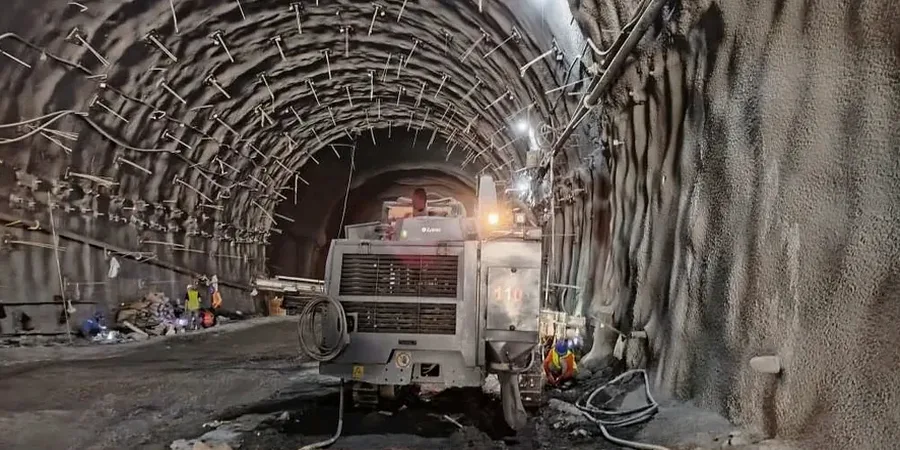
IBC Section 3304 mandates protection of adjacent structures during earthwork. In Cary, North Carolina, where Piedmont residual soils transition abruptly from stiff silty clays to partially weathered rock, this requirement is far from a formality. The Triassic basin geology underlying western Cary creates variable cut conditions that demand continuous verification. We deploy automated total stations, in-place inclinometers, and vibration monitors to track ground response before it becomes a problem. The 2024 North Carolina Building Code adopts ASCE 7-22 risk categories. Our monitoring plans align with these directly. For projects near the high-value residential zones off Kildaire Farm Road or the expanding commercial corridors along NC-55, we integrate real-time threshold alerts with daily engineering review.
This approach is often paired with an initial test pit investigation to calibrate monitoring trigger levels against actual soil stratigraphy before shoring installation begins.
A 0.25-inch lateral movement in Piedmont residual soil can indicate a developing failure plane. We detect it before the excavation crew sees a crack.
Methodology and scope
Local considerations
Cary's transformation from a railroad stop to a 175,000-resident town brought rapid infill development. Old farmland with deep topsoil was compacted for slab-on-grade foundations. These fills, sometimes 8 to 12 feet thick, sit directly against new deep excavations for mixed-use buildings. The interface between compacted fill and natural residual soil is a preferential path for groundwater seepage. Monitoring this zone requires piezometers and observation wells. Without them, a cut face can ravel for days before visible slumping occurs. The cost of repairing a shifted adjacent foundation on a Cary cul-de-sac exceeds any monitoring budget by a factor of ten. Our reports meet the submittal requirements of the Town of Cary Engineering Department and are structured for direct inclusion in the project's SWPPP and Erosion Control Plan documentation.
Applicable standards
ASCE 7-22 Section 12.13: Earth Retaining Structures, IBC 2024 Section 3304: Protection of Adjoining Property, ASTM D7299-20: Standard Practice for Verifying Inclinometer Performance, USBM RI 8507: Blasting Guidance for Vibration Limits, NCDOT Standard Specifications Section 210: Excavation and Embankment
Associated technical services
Deep Excavation Monitoring Package
For cuts exceeding 12 feet or within 30 feet of occupied structures. Includes automated motorized total station with prisms on shoring walers, 3-axis in-place inclinometer chain in soldier beam, standpipe piezometer, and two crack gauges on nearest building. Daily report with deviation plots.
Utility and Pavement Protection Array
For open-cut utility trenches along Cary's collector streets. Settlement points on pavement at 25-foot intervals, vibration monitor at nearest water main, and manual inclinometer probe in portable casing. Weekly summary with cumulative displacement graphs for Town inspector review.
Typical parameters
Frequently asked questions
Does the Town of Cary require excavation monitoring for single-family home construction?
Not as a standard requirement. Monitoring becomes mandatory when the excavation is within 10 feet of an existing structure or when the cut depth exceeds the natural angle of repose for the on-site soil. The Cary Engineering Department reviews this on a case-by-case basis during the building permit phase.
How do you set movement trigger levels for a Cary site?
We calculate trigger levels from the structural tolerance of the nearest adjacent building. A typical wood-frame residence on a slab can tolerate 0.5 inches of differential settlement. We set the yellow alert at 50% of that value (0.25 inches) and the red alert at 75% (0.38 inches). For masonry-clad commercial buildings, the tolerance is tighter — often 0.3 inches total — so triggers are reduced proportionally.
What is the cost range for excavation monitoring in Cary?
A typical monitoring program for a 20-foot-deep commercial excavation in Cary ranges from US$730 to US$2,200 depending on duration, number of instruments, and reporting frequency. A one-month utility trench monitoring array with four settlement points starts near the lower end. A three-month deep excavation package with automated total station, inclinometer chain, and daily reports falls at the higher end.
Can monitoring data help defend against damage claims from neighbors?
Yes. Baseline surveys conducted before excavation establish the pre-construction condition of adjacent properties. Continuous monitoring data with time-stamped readings demonstrates whether movement occurred during construction or predated it. This documentation has resolved disputes in Cary's older neighborhoods where homes date to the 1970s and have pre-existing settlement cracks.